Entre Montagne et Boutières
IMPORTANT : this loop has not yet been cleared to date.
A real hike in the heart of the difficult rating, with elevation gain, distance and routes of all kinds.


This is a hike that really gives the impression of going on an adventure! Starting from Mézilhac, you discover two very different faces of the Ardèche: the vast expanses of the Ardèche Mountains, open to the horizon, and the deep and wooded valleys of the Boutières.
The first part of the trail takes us along old paths, between pastures, small hamlets, and forests. We descend into the Arnaudès valley, where streams and old farmhouses lend the landscape a particularly authentic charm. Then the path climbs again, crosses the woods, and reaches Lachamp-Raphaël, one of the perched villages of the Ardèche Mountains.
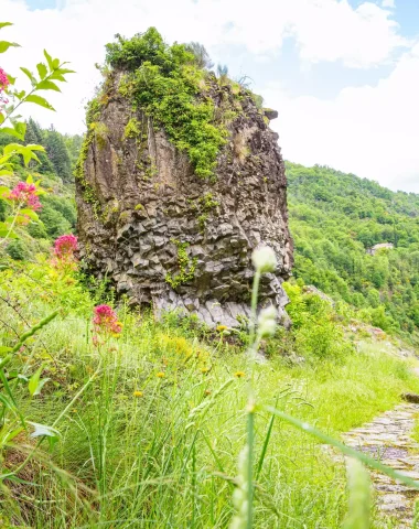
The scenery then changes completely! The forests give way to moors and wide open spaces, with striking volcanic peaks known locally as "sucs." Montivernoux is one of the highlights of the hike. Those who are particularly adventurous can even make a detour to its summit to enjoy a 360° panorama, with views that, on a clear day, can extend all the way to the Alps.
We particularly love this hike for its contrasts: the intimacy of the valleys, the coolness of the undergrowth, and then that wonderful feeling of freedom when you reach the higher ground. A beautiful Ardèche adventure, sporty and refreshing, for those who love long walks and feeling small in the face of the landscapes!
Your questions about hiking
Where can I park near the starting point?
Parking at the church square or at the Col de Mézilhac. Then, start at the “INFO RANDO” sign, overlooking the main street of MEZILHAC on the side of the wash house fountain.
Is the route marked?
Yes! On this hike, you will find GR (white/red) + GRP (yellow/red) markings.
Is this hike suitable for children?
Whoa 😅! With 623m of elevation gain over 15.2km of walking, and some tricky sections, it's far from a walk in the park!
This hike is a real challenge, reserved for experienced hikers. If that's the case for the children you're thinking of taking, why not? But even if they've already done long and difficult hikes, make sure they're truly motivated.
If you want a selection of walks that are really suitable for little ones, 👉🏻 It's this way.
Are dogs allowed on the trails?
Of course Rex is welcome on all the trails in the Aubenas-Vals region!
You will just be asked to keep him on a leash: you will come across other groups of hikers who, unlike you, do not necessarily have the codes to make your beloved pooch obey.
There's also the possibility of encountering herds of livestock on some of the local trails. Sometimes there will even be a sheepdog. Here we explain how to ensure everyone remains calm.
As for Kiki, don't forget to bring enough water for him too. There aren't always streams or other water sources along the trails. In hot weather, remember to moisten his paw pads from time to time.
Finally, it costs nothing to carry a few small dog waste bags in your pocket. It's the kind of thoughtful touch that the Ardèche region loves 😍.
Do you want other activities to do with Toutounet? 👉🏻 It's this way.
Will I have cell service on this hike?
Mobile coverage is pretty good in our part of Ardèche, but by clicking here you can see the coverage specifically for Mézilhac.
Can you follow the hike with your phone?
Yes, and you have 3 options:
→ Either you download the GPX track onto your smartphone. Before leaving, you open it in a hiking app. (We explain everything here)
→ Either you install the Ardèche Mountains hiking app, on which you will find all our hikes (and many more).
→ You can also, from your smartphone, click on the "View step-by-step route" button further down on this page. On this new details page, if you scroll up a bit, you'll see a box labeled "Save this item for offline access." Once you're hiking, whether you're connected or not, but by enabling geolocation, you'll see your progress on the hiking map!

FIND THIS HIKE ON THE MONTS D'ARDECHE HIKING APP. Free and ad-free hiking app
Grab a bite to eat after the hike

We're sure you'll like it.
Do you love nature, wide open spaces and discoveries? Take a look here too!